Isaak Mountain
| Mountain Isaak | |
|---|---|
 | |
| Highest point | |
| Elevation | 1,742 m (5,715 ft) |
| Coordinates | 36°30′41″N 5°03′34″E / 36.5114557°N 5.0594186°E |
| Geography | |
| Parent range | Babor Mountains - Tell Atlas |
| Geology | |
| Age of rock | Quaternary |
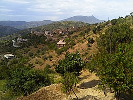
Isaak Mountain is a peak in the Babor Mountains range of the Tell Atlas in Algeria, located in the municipality of Tizi N'Berber in the Aokas District.[1]
Description
[edit]Isaak Mountain is the third highest mountain peak in Béjaïa, at 1,742 m (5,715 ft), right after Babor Mountain 2,004 m (6,575 ft) and Takintosht 1,874 m (6,148 ft), overlooking the eastern Gulf of Béjaïa, and the Soummam Basin, and facing the Babor Mountains and the Djurdjura Mountains.[2]
It is offset by Takintosht in the south of the Soummam Basin, and Yma Quraya Mountain in the west of the Béjaïa Bay, where the city of Béjaïa was established.[3]
The summit of the mountain can be reached via a single national road, National Road 75.[4]
The mountain overlooks the municipality of Aokas and the municipality of Tichy, among other coastal municipalities.[5]
Geology
[edit]The formation of Isaak Mountain dates back to the Quaternary of the Cenozoic on the geologic time scale.[6]
The surrounding terrain is characterized by gray marble that is connected by paths of reddish siderite and iron ore.[7]
The composition of this terrain is also characterized by an amount of crystalline schist and mica schist.[8]

Quarries
[edit]Around the foothill of Isaak Mountain are several quarries that specialize in the extraction of:

These quarries are located at Gedi Ali 1, Gedi Ali 2, and Isaak.
Valleys
[edit]A lot of valleys either originate or surround Isaak Mountain, including:[citation needed]
- Aqrion Valley.[citation needed]
- Bou Sellam Valley.
- Amaseen Valley.[11]

Dams and lakes
[edit]- Egil Amda Dam[12]
- Egzer Oftis Dam[13]
- Chaaba el Akhira Dam[citation needed]
Ecological diversity
[edit]Trees
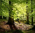
[edit]Many types of trees surround Isaak Mountain and it's it's forests.[14]
Barbarian macaque
[edit]
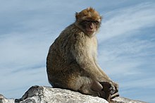
The Barbary macaque is found near Isaak Mountain, and sometimes ventures out into roads and populated areas to ask for food.[15]
The Algerian government has taken several measures to protect this endangered animal.[16] For example, signs are posted in places where the animals are found to prevent people from feeding the monkeys, as some of the foods people give the monkeys can lead to their death. Also preventing them from owning them for breeding purposes.[17]
The Algerian government has also initiated the creation of several nature reserves where large numbers of the species are found, such as the Taza National Park and the Goraya National Park overlooking the Bay of Bejaia, as well as the Djurdjura National Park.[18]
Animals
[edit]Many species of mammals live in the Babor Mountains within the forests of the Isaak forest and as well other forests.[19]
Archaeological sites
[edit]In the peaks and the foothills of Isaak Mountain is a collection of monuments that date back to the Roman civilization.[20]
It also has some ancient cave entrances to mines dating back to the same Roman period.
Photo gallery
[edit]-
Location of mountain Bouzgeza
See also
[edit]- Tell Atlas
- Khachna mountains
- Kabylia
- East–West Highway (Algeria)
- Aokas District
- Tizi N'Berber
- Béjaïa Province
References
[edit]- ^ Noor Library- Isaak Mountain
- ^ Le Bois de Ben Haroun Archived September 23, 2016 at Wayback Machine.
- ^ Djazairess : Ruée sur les monts Takoucht et Adhrar N'fadh Archived December 06, 2017, at Wayback Machine.
- ^ Activités de developpement 2013 - fassmdz Archived December 06, 2017, at Wayback Machine.
- ^ Les montagnes de Kabylie sécurisées du jour au lendemain ? - Tamurt.info Archived December 21, 2017, at Wayback Machine.
- ^ https://web.archive.org/web/20170329145903/http://www.pap-thecoastcentre.org/pdfs/Urbanisation-artificialisation%20des%20sols.pdf. Archived from the original (PDF) on 2017-03-29.
- ^ Bulletin de la Société géologique de France Archived December 17, 2019, at Wayback Machine.
- ^ https://web.archive.org/web/20160303234621/http://storage.lib.uchicago.edu/pres/2014/pres2014-0313.pdf. Archived from the original (PDF) on 2016-03-03.
- ^ https://web.archive.org/web/20170202061718/http://biblio.univ-alger.dz/jspui/bitstream/1635/387/1/33166%20T4.pdf. Archived from the original (PDF) on 2017-02-02.
- ^ https://web.archive.org/web/20170202061718/http://biblio.univ-alger.dz/jspui/bitstream/1635/387/1/33166%20T4.pdf. Archived from the original (PDF) on 2017-02-02.
- ^ Hespress- Amseen Valley
- ^ Algeria Press Service- Egil Amda Dam in srevice.
- ^ Information about the Egzer Oftis Dam-Safarway
- ^ "Archived copy". Archived from the original (PDF) on 2020-08-19. Accessed on 2017-12-05.
- ^ “monkey tourism” brings thousands of tourists to Algeria annually- al ain
- ^ The Barbary macaque is threatened with extinction!!- France24
- ^ Algerian "Akroun" forest: a paradise for the mago monkeys- Elaph
- ^ Djergera Park... An Algerian reserve awaiting rehabilitation-albayan
- ^ Isaak Mountain a place for tourism and nature- tahwaspresse
- ^ The Roman Monuments in Algeria- Edarabia
External links
[edit]Videos
[edit]- View of Isaak Mountain from the municipality of Tizi N'Berber, Béjaïa.
- A walking tour to Isaak Mountain in the municipality of Tizi N'Berber, Béjaïa Province.
- Celebrating Nature Day in the municipality of Tizi N'Berber, in Béjaïa.
- Takintosht Mountain in the municipality of Kandira, Béjaïa Province.
- The first edition of the Takintosht Mountain Festival from July 13 to 15, 2017 in Béjaïa.
- The Battle of Takintosht Mountain and Isaak Mountain on February 29, 1960, near the village of Qamat in Bejaia.


